A strong Ha Giang loop itinerary for photographers is not just about covering distance. It is about light, timing, weather, and knowing when to stop instead of rushing to the next checkpoint. Ha Giang is one of the most photogenic regions in Vietnam, with winding mountain roads, limestone peaks, deep valleys, ethnic markets, and layers of mist that can completely change the mood of a frame within minutes. Vietnam’s tourism board describes the loop as one of the country’s ultimate road trips and says it is best done over three to five days, which makes it ideal for photographers who need time to wait for the right conditions instead of simply riding through.
The setting itself is part of what makes this route so visually rewarding. Ha Giang City is the main gateway to the province, around 300 km from Hanoi, with buses running day and night from the capital. Once you leave the city, public transport is limited, which is why most travelers either rent a motorbike, ride with an experienced driver, or join a tour. For photographers, that limited infrastructure is actually part of the appeal: the farther you go, the more the landscape opens into something raw, quiet, and cinematic.
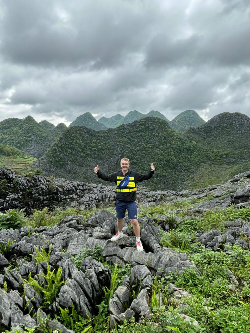
Another reason this route stands out is the geology. The Dong Van Karst Plateau is recognized as a UNESCO Global Geopark, which helps explain why the area feels so visually dramatic. Jagged limestone formations, tight passes, layered valleys, and cliff-edge roads create a landscape with constant contrast and depth. That is exactly what landscape and travel photographers usually want: scale, texture, human detail, and a route where the view changes every few kilometers.
Perfect Tours for You:
Day 1: Ha Giang City to Yen Minh
The best way to start a Ha Giang loop itinerary for photographers is slowly. Leave Ha Giang City early, ideally after sunrise, so you can use the morning light on the first climbs out of town. According to Vietnam Tourism, the first major photographic highlight is Heaven’s Gate Pass, reached as the road enters the Dong Van Karst Plateau. This stretch gives you sweeping mountain views and tight curves that work especially well for wide landscape shots, drone-style compositions from viewpoints, and road-in-the-frame images.
After Heaven’s Gate, the route drops toward Tam Son, where the landscape becomes softer and greener before tightening again on the road to Yen Minh. This is a good first-night stop for photographers because it keeps day one manageable and leaves room for spontaneous stops. Instead of trying to push too far, use the afternoon for roadside portraits, layers of karst hills, and village-life details. The official route notes that the road follows the Mien River before climbing through canyon scenery into Yen Minh, so this section works well for environmental photography and transitional landscape frames.
For photography, day one is less about collecting famous landmarks and more about finding rhythm. Stop when you see fog moving through the hills, when sunlight breaks through clouds, or when a rider appears at the right moment on a bend. Ha Giang rewards patience more than speed, and Yen Minh is a good place to end the day before the loop becomes even more visually intense.
Day 2: Yen Minh to Dong Van
Day two is where the route becomes much more dramatic. Vietnam Tourism highlights Dốc Chín Khoanh (Nine Turn Pass) as one of the standout places on the road from Yen Minh toward Dong Van. It is a natural stop for photographers because the descending curves create strong leading lines and layered compositions. If the weather is clear, you can shoot the geometry of the road itself. If mist rolls in, the scene turns softer and more atmospheric. Either way, it is one of the most photogenic sections of the loop.
From there, keep going toward the Sà Phìn area and onward to Lũng Cú Flag Tower if you have time for the detour. Vietnam Tourism notes that this side trip offers 360-degree views over the border landscape, making it especially rewarding for photographers who want panoramic frames rather than roadside images alone. The road back toward Dong Van also offers no shortage of viewpoints, so this is a day to budget extra time and keep your camera accessible.
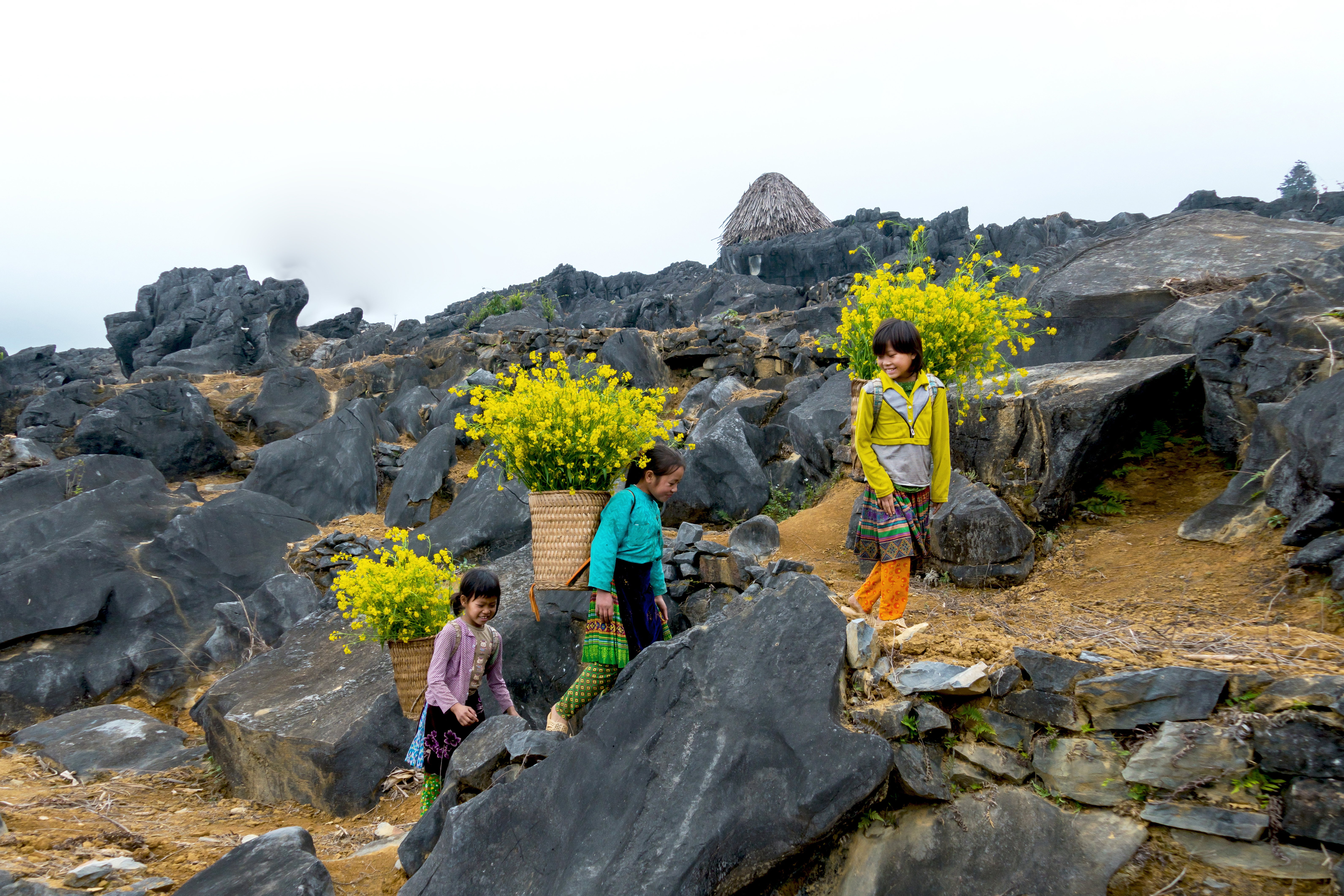
Dong Van itself is worth photographing, not just sleeping in. The official itinerary recommends visiting the local market either at night or early in the morning, where colorful ethnic communities gather. For travel and documentary photographers, this is one of the best places on the loop to capture texture, clothing, gesture, and everyday life instead of only grand scenery. The contrast between monumental landscapes during the day and human detail in the market is what makes a photography-focused Ha Giang trip feel complete.
Day 3: Dong Van to Ma Pi Leng Pass to Bao Lam
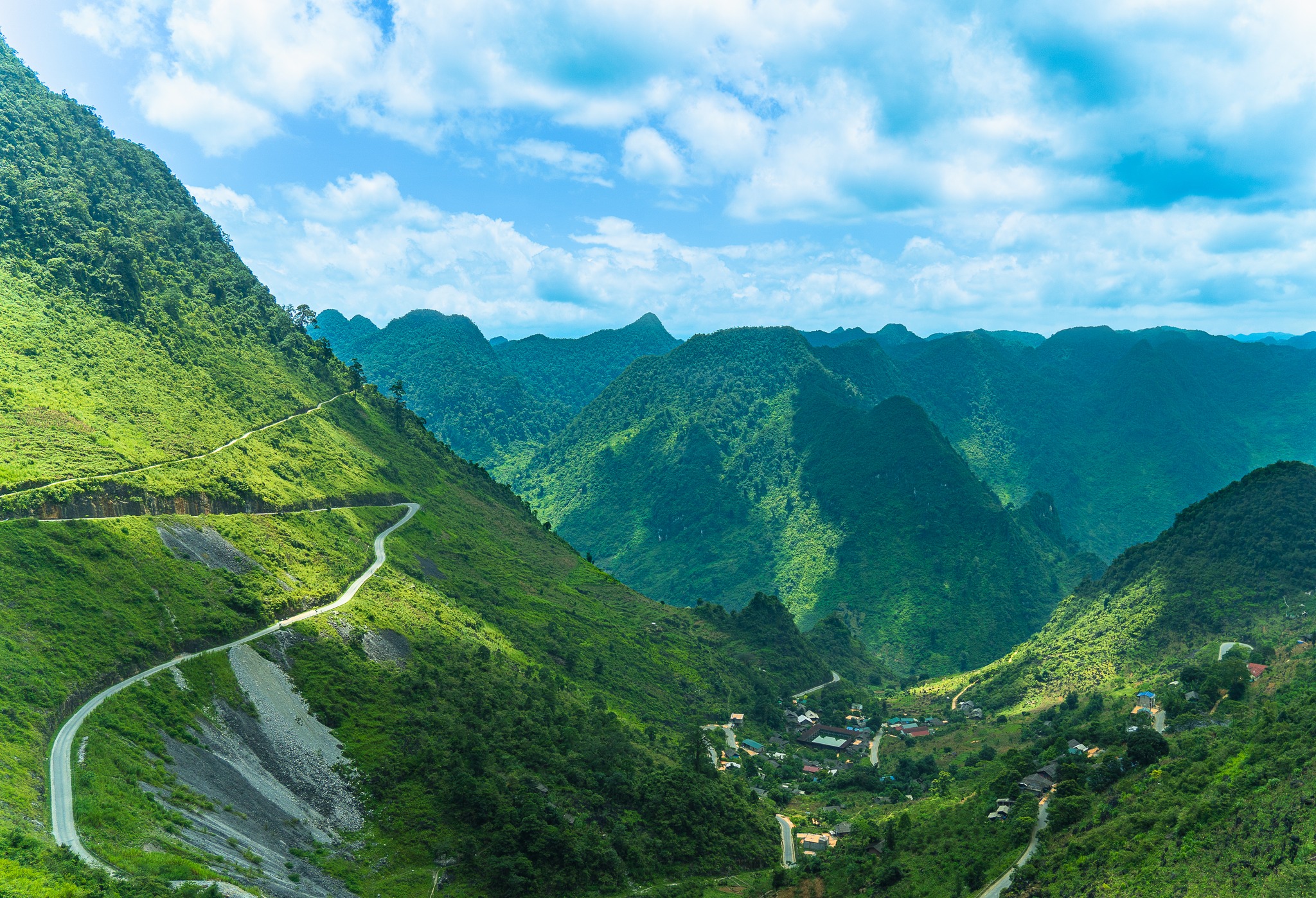
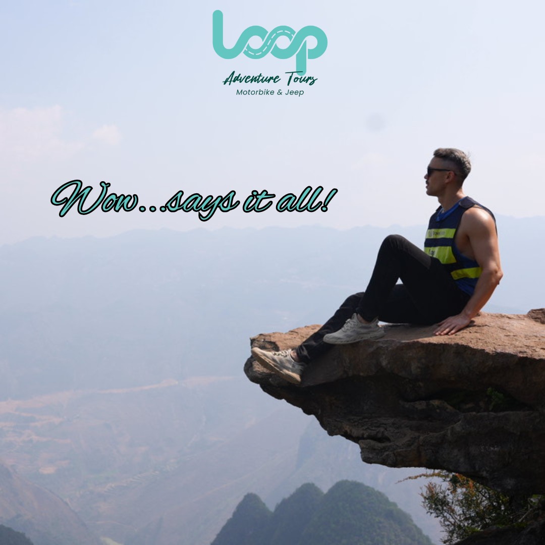
This is the day most photographers are really waiting for. Vietnam Tourism describes the stretch from Dong Van to Ma Pi Leng Pass as arguably the most mind-blowing road in Vietnam, and notes that every turn is packed with picture-perfect views. That is exactly why your start should be early. If possible, get out before traffic builds and before the light becomes harsh. Low-angle morning light gives the cliffs, ridgelines, and valley walls much better shape than midday sun.
The road from Dong Van to Mèo Vạc is only about 24 km, but the official guide makes clear that it can take most of the morning if you stop often for the panoramas. That is ideal for photographers. This is not a day to rush. This is the part of the loop where you want wide shots, telephoto compression of mountain layers, road-perspective frames, and human-scale images with riders crossing the landscape. If you want a closer view of the Nho Quế River, Vietnam Tourism also recommends the short detour down road 193A at the bottom of Mã Pí Lèng Pass.
Season also matters here. Vietnam Tourism notes that from October to December, Ha Giang’s buckwheat, canola, and mustard flowers add strong color to the landscape, and another official tourism page specifically highlights buckwheat fields and Ma Pi Leng’s sweeping curves as a major visual draw. For photographers, that makes late autumn one of the most attractive times to shoot the loop.
Bao Lam is a quieter finish to the day. After a visually intense morning and afternoon, it gives you a more remote overnight stop and a chance to back up photos, review shots, and prepare for the final leg.
Day 4: Bao Lam back to Ha Giang City
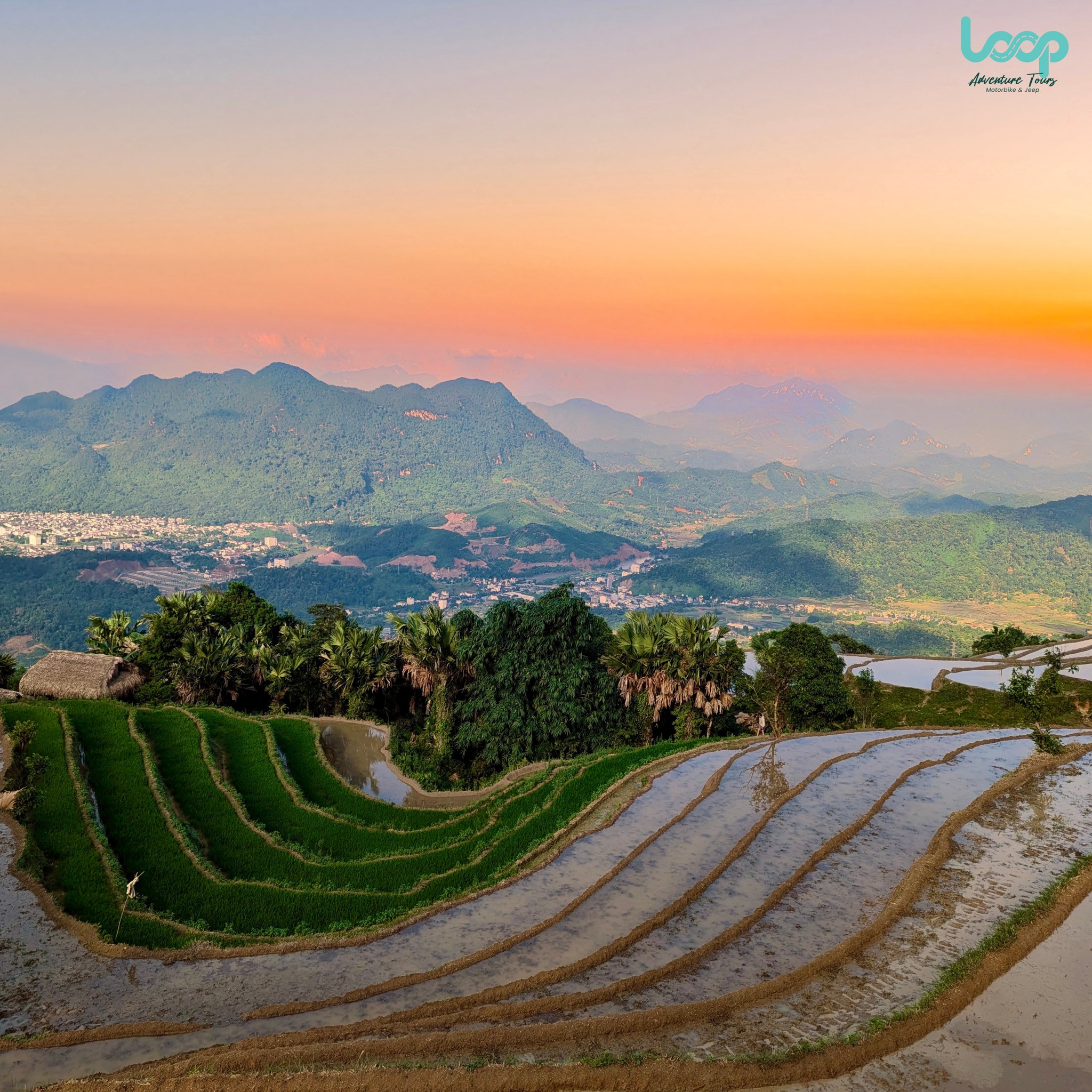
The last day is gentler, but it is still useful photographically. Vietnam Tourism says the road back follows the Gâm River for much of the journey, with valley-floor scenery and fewer strenuous passes than earlier days. That makes it a good day for a different kind of image-making: softer landscapes, village-edge scenes, roadside detail, and quieter closing frames that help round out the story of your trip.
Photography tips for the Ha Giang loop
The most practical tip is simple: plan around light, not mileage. A good Ha Giang loop itinerary for photographers needs room for unplanned stops. Keep lenses easy to reach, protect gear from dust and sudden weather changes, and avoid building a schedule so tight that you miss the best moments.
Safety matters too. Vietnam Tourism advises riders to approach curves carefully, drive in daylight, and stop after dark. That is good travel advice, but it is also good photography advice. The best images usually come when you are not rushing tired into the next town.
In the end, Ha Giang is not only a route. It is a place where road, geology, weather, and culture all work together in the frame. If your goal is to come back with more than just quick snapshots, this Ha Giang loop itinerary for photographers gives you the time and structure to do it properly.
If you want a simpler way to plan the trip, it is worth checking out The Loop Tours before you decide. Their current lineup includes a 3 Days Ha Giang option for travelers short on time, a 4 Days Ha Giang route for a slower pace, and longer Ha Giang – Cao Bang combinations for those who want a bigger Northern Vietnam adventure. They also offer different travel styles, including Self Rider, Easy Rider, and Jeep, so you can choose the level of freedom or comfort that suits you best. For many visitors, especially first-timers, this can be a practical way to enjoy the scenery, local culture, and key highlights of the loop without having to organize every detail on their own.
👉 Call/WhatsApp The Loop Tours — Hotline: +84862443320