Finding the best drone spots in Ha Giang can help you capture some of the most dramatic mountain scenery in northern Vietnam. Ha Giang is famous for its winding passes, limestone peaks, deep valleys, terraced fields, ethnic villages, and the legendary Ha Giang Loop. From above, the landscape becomes even more impressive: roads curve like ribbons through the mountains, rivers cut through canyons, and villages sit quietly between layers of karst peaks.
However, flying a drone in Ha Giang requires more than just choosing a beautiful viewpoint. Vietnam has strict drone regulations, and Ha Giang is close to sensitive border areas. Several travel and drone-law guides note that drone use in Vietnam is regulated and generally requires permission, especially for heavier drones or flights near restricted areas. Because rules can change, travelers should check current requirements, avoid border zones and military areas, and fly responsibly.
For travelers who want a smoother route with scenic stops, The Loop Tours can help plan your Ha Giang Loop itinerary, including safe viewpoints, overnight stays, and local guidance. Recommended stays such as Loop Eco Stone House Ha Giang and Dong Van Eco Stone House are convenient bases before, during, or after your drone-friendly mountain adventure.
Important Drone Rules Before Flying in Ha Giang
Before looking at the best drone spots in Ha Giang, it is important to understand the basics. Vietnam allows drone use, but it is not a completely free-fly destination. Tourists may need approval or permission depending on drone type, location, and flight purpose. Some guides also note that drones weighing 250g or more may face stricter requirements.
You should avoid flying near military sites, police checkpoints, border areas, airports, crowds, private homes, and busy roads. Ha Giang is close to the China border, so extra caution is necessary. A Ha Giang travel guide also warns that drone regulations near border zones can be strict and may change, so checking the latest rules before bringing or flying a drone is important.
Even when you are in a scenic rural area, fly with respect. Keep flights short, avoid disturbing local people or animals, and do not fly directly over villages without permission. The best drone shots in Ha Giang usually come from open natural viewpoints, not from flying over private homes.
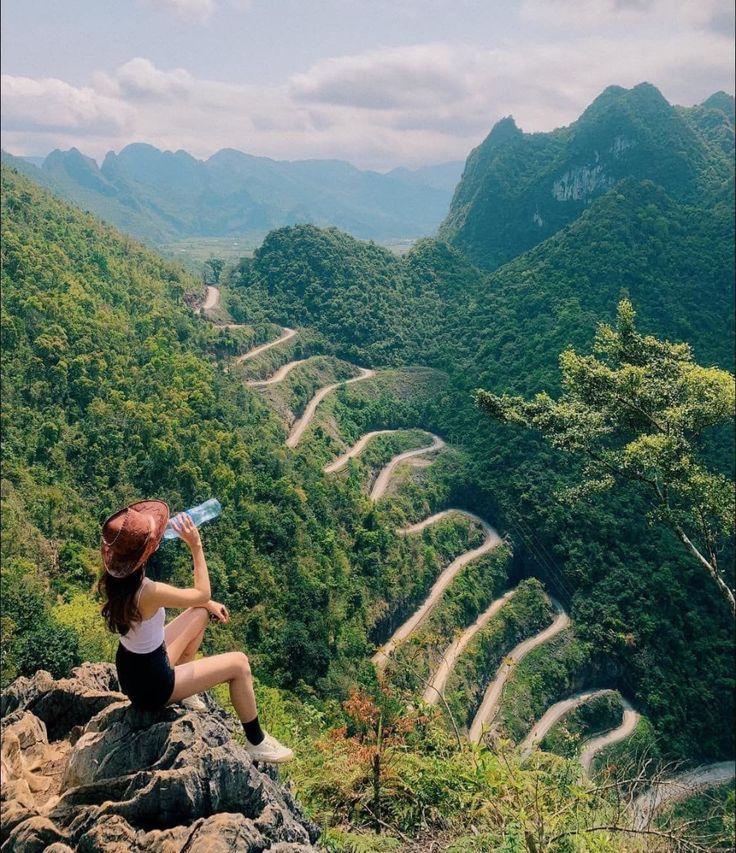
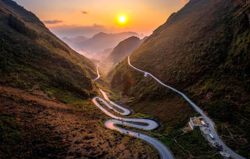
Ma Pi Leng Pass
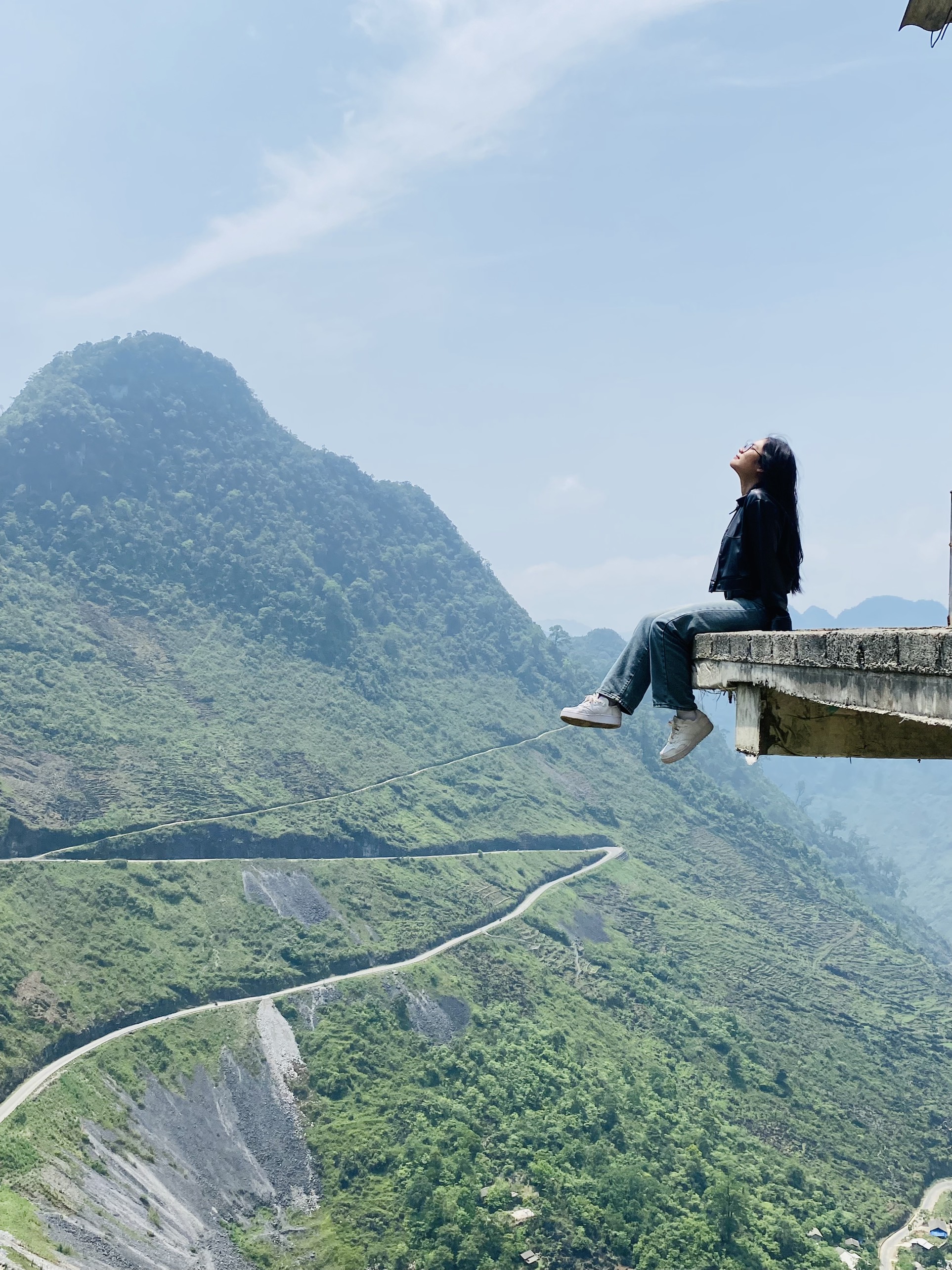
Ma Pi Leng Pass is one of the most iconic drone spots in Ha Giang. Located between Dong Van and Meo Vac, this pass is famous for steep cliffs, sharp curves, and views over the Nho Que River canyon. It is often considered one of the most spectacular sections of the Ha Giang Loop.
From the air, Ma Pi Leng offers dramatic compositions. You can capture the road winding along the cliff edge, layers of limestone mountains, and the river far below. The best time for drone shots is usually early morning or late afternoon, when the light is softer and the shadows add depth to the landscape.
Be careful with wind conditions here. Mountain passes can be unpredictable, and strong gusts may make flying risky. Always launch from a safe roadside area away from traffic, and avoid flying too close to cliff edges or people.
Nho Que River Viewpoints
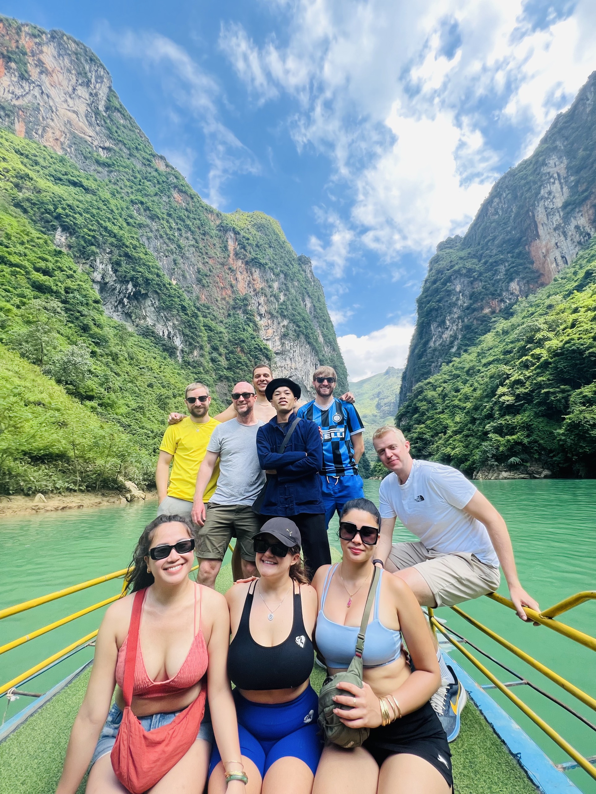
The Nho Que River is one of the most beautiful natural features in Ha Giang. Its green water flows through deep canyons beneath Ma Pi Leng Pass, creating a stunning contrast between river, rock, and mountain.
Drone shots around the Nho Que River can be spectacular, especially from approved and safe viewpoints above the canyon. A Ha Giang drone guide lists the Nho Que River viewpoint from the Ma Pi Leng Skywalk area as one of the top aerial spots on the loop.
If you plan to fly near the river, avoid flying too low over boats or people. Also remember that canyon winds can affect drone stability. Keep the drone within visual line of sight and bring extra batteries, because flying in mountain areas can use power faster than expected.
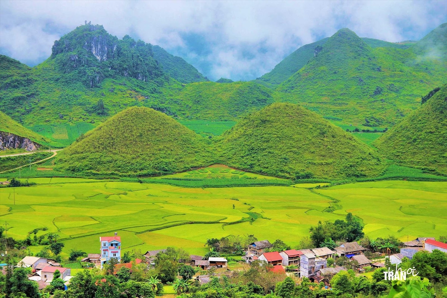
Quan Ba Heaven Gate and Twin Mountains
Quan Ba Heaven Gate is one of the first major viewpoints on the Ha Giang Loop. It offers panoramic views over Tam Son Valley and the famous Twin Mountains. This is one of the most accessible drone spots in Ha Giang and a strong choice for travelers who want wide valley shots early in the journey.
A Ha Giang photography guide lists Quan Ba Heaven Gate and the Twin Mountains as one of the top photo spots on the loop, noting that late afternoon light can be especially beautiful over the karst landscape.
From above, you can capture the valley, roads, rice fields, villages, and rounded hills that make Quan Ba so recognizable. This area is best flown in calm weather. Avoid launching directly from crowded viewpoints; instead, find a safe open space where you are not blocking visitors or traffic.
Tham Ma Pass
Tham Ma Pass is famous for its elegant hairpin curves and mountain backdrop. It is one of the most photographed sections of the loop and a great location for drone footage of roads cutting through the highland landscape.
From above, Tham Ma Pass gives you a clean view of the winding road pattern, which looks especially striking when motorbikes move through the bends. A Ha Giang Loop drone guide includes Tham Ma Pass among the top aerial spots on the route.
For the best results, fly when traffic is light and visibility is clear. Do not hover low above moving vehicles, and avoid distracting riders. Safety should always come before getting the perfect shot.
Dong Van Karst Plateau
Dong Van is not only one of the most important overnight stops on the Ha Giang Loop, but also a gateway to the Dong Van Karst Plateau. The surrounding limestone formations, old stone houses, and rugged mountain terrain make this area excellent for landscape photography.
Drone footage around Dong Van can capture a mix of cultural and natural scenery. The town itself is charming, but you should avoid flying over crowded areas, the old quarter, markets, or private homes. Instead, choose open viewpoints outside town where you can capture the mountains and roads without disturbing local life.
For accommodation, Dong Van Eco Stone House by The Loop Tours is a convenient base. Staying in Dong Van allows you to explore nearby viewpoints, rest before Ma Pi Leng Pass, and plan drone flights at safer times of day.
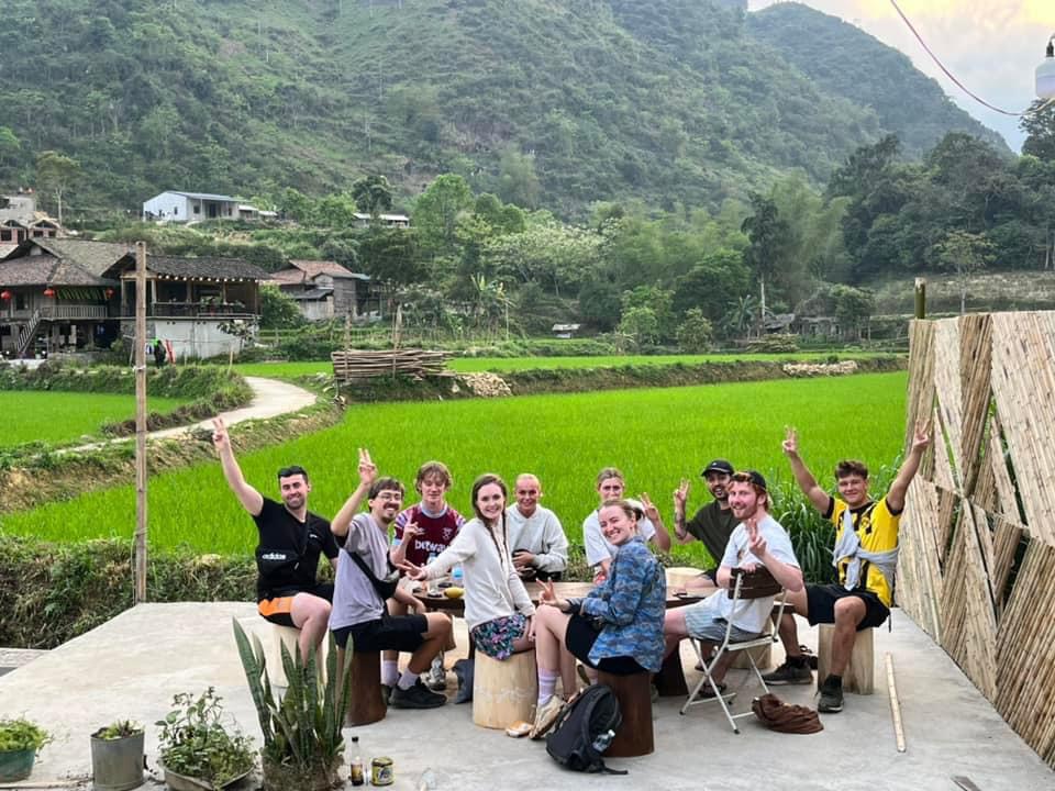
Du Gia Valley
Du Gia offers a softer and greener side of Ha Giang. Instead of sharp cliff roads, you get valleys, rice fields, waterfalls, small villages, and peaceful countryside scenery. It is one of the best drone spots in Ha Giang for travelers who want calm, rural aerial footage.
A Ha Giang drone guide lists Du Gia Valley and waterfalls among the top drone spots on the loop. The area is especially beautiful in the early morning, when mist may hang over the valley, or in late afternoon, when warm light spreads across the fields.
Because Du Gia is a living village area, fly respectfully. Avoid flying directly above houses, people, livestock, or private land without permission. A quiet, open field or hillside viewpoint is usually better than launching from inside the village center.
Meo Vac Mountain Roads
Meo Vac is surrounded by rugged mountains and dramatic roads, making it a strong drone location for wide highland shots. The area is especially useful if you want aerial footage after exploring Ma Pi Leng Pass but before continuing deeper into the loop.
From above, the roads around Meo Vac show the scale of Ha Giang’s terrain. You can capture limestone ridges, valleys, villages, and motorbikes moving through remote mountain sections. Since Meo Vac is less crowded than some famous viewpoints, it may be easier to find quiet places to fly.
Still, be careful with weather and visibility. Fog can appear quickly in the mountains, and wind conditions can change within minutes.
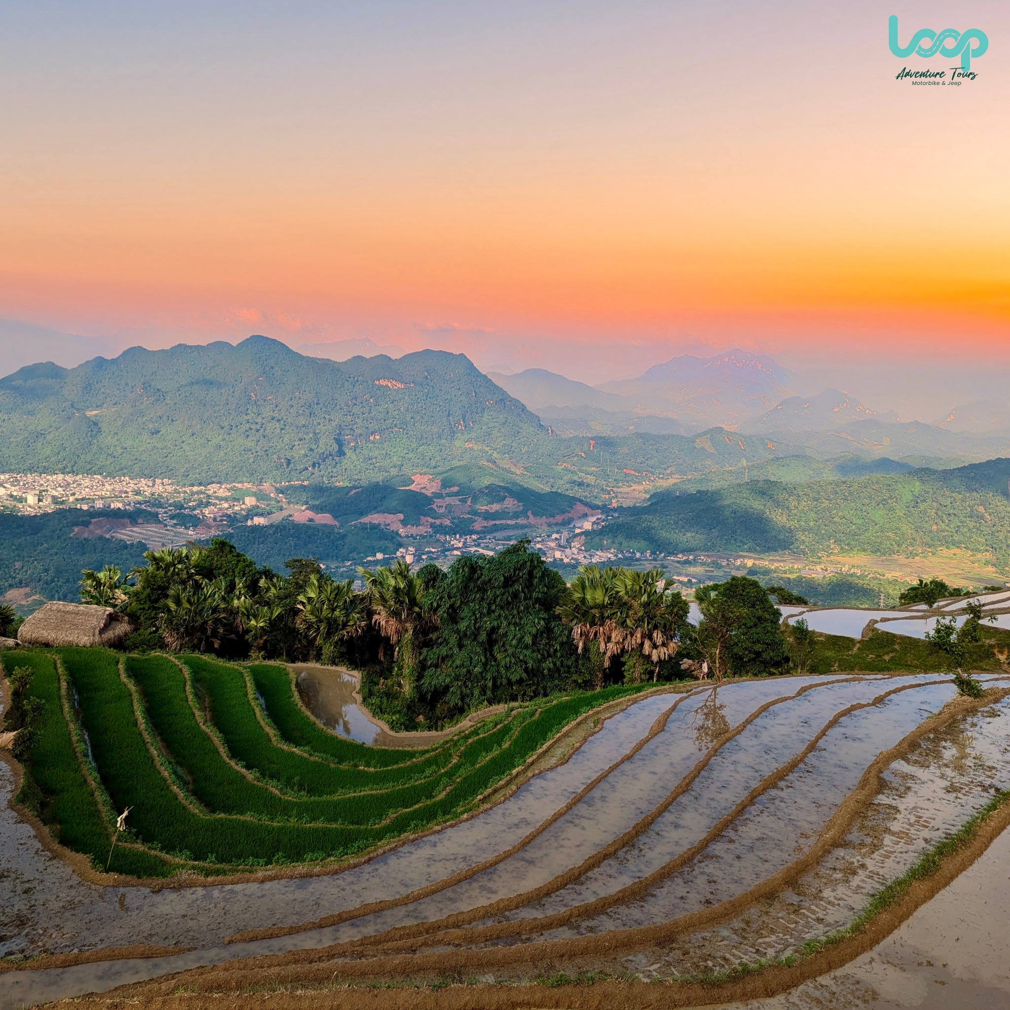
Rice Terraces and Rural Roads Near Yen Minh
Yen Minh is often used as a first-night stop on a 4-day loop. The area is quieter than Dong Van and is surrounded by pine forests, villages, fields, and winding roads. While it may not be as dramatic as Ma Pi Leng, it is excellent for peaceful drone footage.
The best shots near Yen Minh often include roads passing through valleys, small houses, fields, and layered mountain slopes. This is a good place to capture the slower rhythm of Ha Giang rather than only the most famous viewpoints.
Yen Minh can also be a safer place for beginner drone users because the terrain is often more open than cliffside areas. Still, check local conditions and avoid flying over people or homes.
Best Time to Fly a Drone in Ha Giang
The best drone footage usually comes during early morning and late afternoon. Morning light is soft, roads are quieter, and mist can create a cinematic effect in valleys. Late afternoon gives warm golden light, but you should avoid flying too close to sunset if you still need to ride to your accommodation.
Weather is a major factor. Ha Giang can be foggy, windy, or rainy, especially in mountain passes. Do not fly in strong wind, low cloud, rain, or poor visibility. Always keep your drone within visual line of sight and leave enough battery for a safe return.
Drone Safety Tips for the Ha Giang Loop
Before every flight, check the area carefully. Look for power lines, cliffs, trees, vehicles, people, and animals. Choose a stable launch spot away from traffic. Keep flights short and controlled, especially in mountain wind.
Do not fly near police checkpoints, military areas, border zones, or crowded markets. Do not fly low over local homes or people without permission. Be respectful if someone asks you to stop.
If you are traveling with an Easy Rider or guide, ask them where it is safe and appropriate to fly. Local drivers often know which places are scenic, quiet, and less sensitive. Booking with The Loop Tours can help you plan your photo stops more smoothly while keeping safety and local respect in mind.
Final Thoughts
The best drone spots in Ha Giang combine dramatic scenery, open space, safe conditions, and responsible flying. Ma Pi Leng Pass and the Nho Que River offer the most iconic aerial views, while Quan Ba Heaven Gate, Tham Ma Pass, Dong Van, Meo Vac, Yen Minh, and Du Gia each bring a different visual style to your footage.
Before flying, always check the latest drone rules in Vietnam, avoid restricted areas, and respect local communities. A beautiful drone shot is only worth it when it is captured safely and responsibly.
Ready to capture Ha Giang from a new perspective? Book your Ha Giang Loop journey with The Loop Tours and enjoy well-planned routes, scenic viewpoints, and comfortable stays such as Loop Eco Stone House Ha Giang and Dong Van Eco Stone House for a smoother, safer, and more memorable mountain adventure.
👉 Call/WhatsApp The Loop Tours — Hotline: +84862443320