The Ha Giang Loop has quickly become one of the most iconic motorbike adventures in Vietnam. Famous for its winding mountain passes, breathtaking rice terraces, and authentic ethnic minority culture, it attracts thousands of adventurous travelers every year. But before hitting the road, many first-time visitors ask: Where does the Ha Giang Loop start on the map? In this guide, we’ll show you the exact starting point, explain the best routes to take, highlight key attractions along the way, and share useful tips to plan your unforgettable journey.
Recommended Tours for You:

Where Does the Ha Giang Loop Start on the Map?
The Ha Giang Loop starts in Ha Giang City, the capital of Ha Giang Province in northern Vietnam.
-
Location on the map: Ha Giang City is about 300 km north of Hanoi, close to the Chinese border.
-
Coordinates: Approximately 22.8°N, 104.98°E.
-
Transport to Ha Giang City:
-
From Hanoi, you can take an overnight sleeper bus (6–7 hours).
-
Private cars and limousine vans are also available.
-
No airport or train line connects directly to Ha Giang.
-
👉 In short: Ha Giang City is the official gateway and starting point for the loop.
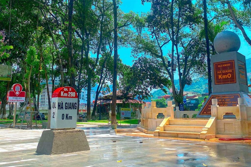
Why Ha Giang City Is the Starting Point
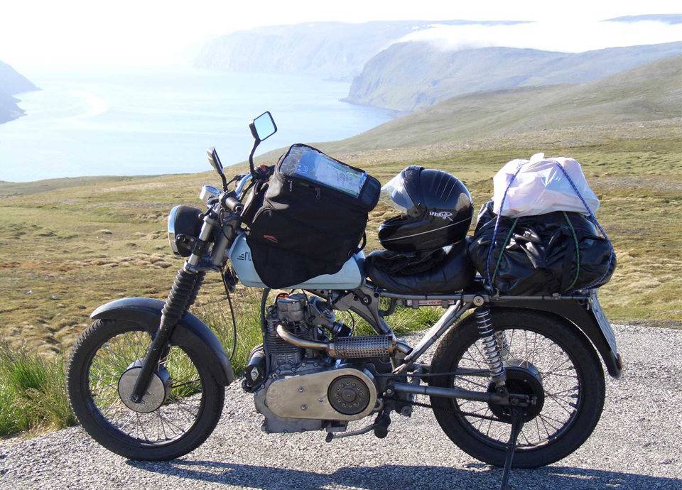
Motorbike Rentals
-
Most motorbike rental shops are based in Ha Giang City.
-
Here, travelers choose manual or semi-automatic bikes.
-
Shops also provide helmets, safety gear, and maps.
Permits and Paperwork
-
A travel permit is required to enter border areas like Dong Van and Meo Vac.
-
Permits can be arranged at hotels, rental shops, or the immigration office in Ha Giang City.
Accommodation and Supplies
-
The city offers hostels, homestays, and guesthouses.
-
Good place to rest before starting the adventure.
-
Supermarkets and ATMs are available for stocking up.
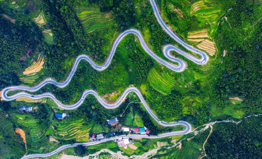
The Main Routes of the Ha Giang Loop
Once you leave Ha Giang City, there are two common directions to begin the loop: clockwise or counterclockwise.
1. Clockwise Route (Most Popular)
-
Day 1: Ha Giang City → Quan Ba → Yen Minh → Dong Van.
-
Day 2: Explore Dong Van → Lung Cu Flag Tower.
-
Day 3: Dong Van → Ma Pi Leng Pass → Meo Vac → Du Gia.
-
Day 4: Du Gia → Lung Tam → Ha Giang City.

Why choose this route?
-
Covers all highlights in an easy-to-follow circle.
-
Gradual road conditions – good for first-timers.
2. Counterclockwise Route
-
Day 1: Ha Giang City → Du Gia → Meo Vac.
-
Day 2: Meo Vac → Ma Pi Leng Pass → Dong Van.
-
Day 3: Dong Van → Yen Minh → Quan Ba → Ha Giang City.
Why choose this route?
-
See Ma Pi Leng Pass earlier in the trip.
-
Slightly fewer tourists on some stretches.
👉 Both routes start and end in Ha Giang City.
Key Attractions Along the Loop
-
Quan Ba Heaven Gate: First major viewpoint after leaving Ha Giang City.
-
Dong Van Karst Plateau: UNESCO Global Geopark with unique limestone formations.
-
Lung Cu Flag Tower: Northernmost point of Vietnam.
-
Ma Pi Leng Pass: One of Southeast Asia’s most stunning mountain passes.
-
Meo Vac: Famous for Sunday ethnic market.
-
Du Gia Village: Known for homestays, rice fields, and waterfalls.

Map Overview of the Ha Giang Loop
On a Vietnam map, you’ll see the loop forming a rough circle:
-
Start/End: Ha Giang City.
-
Northern Section: Dong Van and Lung Cu near the Chinese border.
-
Eastern Section: Ma Pi Leng Pass and Meo Vac.
-
Southern Return: Du Gia and back to Ha Giang City.
Estimated distance: 350–400 km depending on detours.
How Many Days Should You Spend on the Loop?
-
3 Days: Fast-paced, covering highlights but rushed.
-
4 Days: Most popular, balanced pace with enough time for stops.
-
5 Days: Ideal for slow travelers, with more village experiences.
👉 Most travelers choose 4 days for the best experience.

Tips for Starting the Ha Giang Loop
Arrive in Ha Giang City the Night Before
-
So you can rest and start early the next morning.
Check Your Bike Thoroughly
-
Brakes, tires, and lights are essential for mountain roads.
Get Your Permit
-
Needed for border areas like Dong Van and Lung Cu.
Pack Smart
-
Rain gear, warm clothes (it’s chilly in the mountains), and enough cash.
Safety First
-
Roads can be dangerous for beginners. If unsure, hire an easy rider (local driver).
Common Mistakes Travelers Make
-
Thinking the loop starts in Hanoi: The loop officially starts in Ha Giang City, not Hanoi.
-
Underestimating road conditions: Roads are steep, narrow, and winding.
-
Skipping travel permits: You risk fines at checkpoints without one.
-
Not fueling up: Gas stations are limited in remote areas.

Frequently Asked Questions
1. Where exactly does the Ha Giang Loop start?
In Ha Giang City, the capital of Ha Giang Province.
2. Can I rent a motorbike in Hanoi instead?
Technically yes, but it’s not recommended. It adds 6–7 hours of riding before even starting the loop. Most travelers take a bus to Ha Giang City and rent a bike there.
3. Do I need a permit to start the loop?
Yes, a travel permit is required for border zones. It can be obtained easily in Ha Giang City.
4. How far is Ha Giang City from Hanoi?
About 300 km (6–7 hours by bus).
5. Can I do the loop by car instead of a motorbike?
Yes, but roads are narrow. Motorbikes are more flexible and adventurous.

Conclusion
So, where does the Ha Giang Loop start on the map?
The answer is clear: Ha Giang City. It’s the gateway to Vietnam’s most scenic motorbike journey, the place where you’ll rent your bike, get your permit, and begin your adventure.
From there, the loop takes you through mountains, valleys, and ethnic villages, with Dong Van, Ma Pi Leng Pass, Meo Vac, and Du Gia as major highlights. Whether you choose a 3-day, 4-day, or 5-day journey, starting from Ha Giang City ensures you’re on the right path.
No matter your route, the Ha Giang Loop will reward you with breathtaking landscapes and unforgettable cultural experiences – making it one of the greatest adventures in Southeast Asia. Plan your adventure today! For more details and personalized support, contact Thelooptours Hotline: +84329196074.